We transform raw LiDAR data into precise 2D CAD drawings and intelligent 3D BIM models. Experience the seamless transition from site reality to digital accuracy.
Typical 48-hour delivery for standard floor plans.
Deliverables for Revit, Archicad, AutoCAD, and SketchUp.
Strict NDA compliance and secure data handling protocols.
We bridge the gap between reality capture and digital design with three specialized pillars of service.
Advanced segmentation of raw LiDAR data. We isolate vegetation, ground surfaces, buildings, and noise.
Precise conversion of scan data into 2D deliverables. Detailed floor plans, elevations, and site plans.
Creation of intelligent 3D models (LOD 200-400). Compatible with Revit, Archicad, and SketchUp.
Providing tailored reality capture solutions for professionals across the built environment.
As-built documentation for renovation and retrofit projects.
Plant layout, piping interference checks, and facility management.
Historical preservation and detailed facade recording.
Roads, bridges, and topographic site analysis.
Showcasing the precision and quality of our digital deliverables.
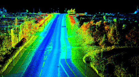
High-precision point cloud data of a roadway, classified for ground and features.
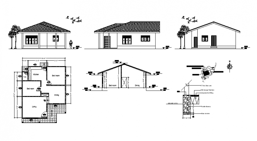
Detailed 2D CAD elevation drawing of a residential facade, generated from laser scan data.
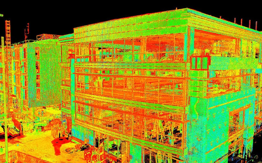
Parametric Revit models created from point clouds for industrial facilities.
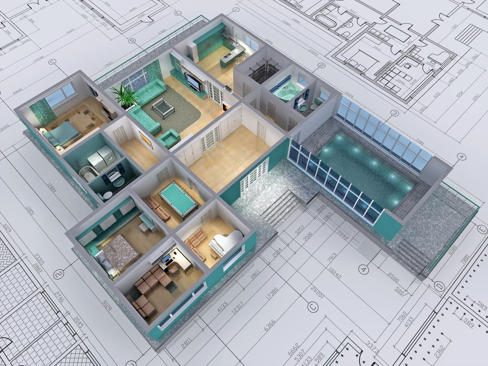
Intelligent 3D BIM model of a house, perfect for renovation and design verification.
Whether you have a small residential scan or a massive industrial facility, our team is ready to process your data with precision. Fill out the form to get a custom quote.